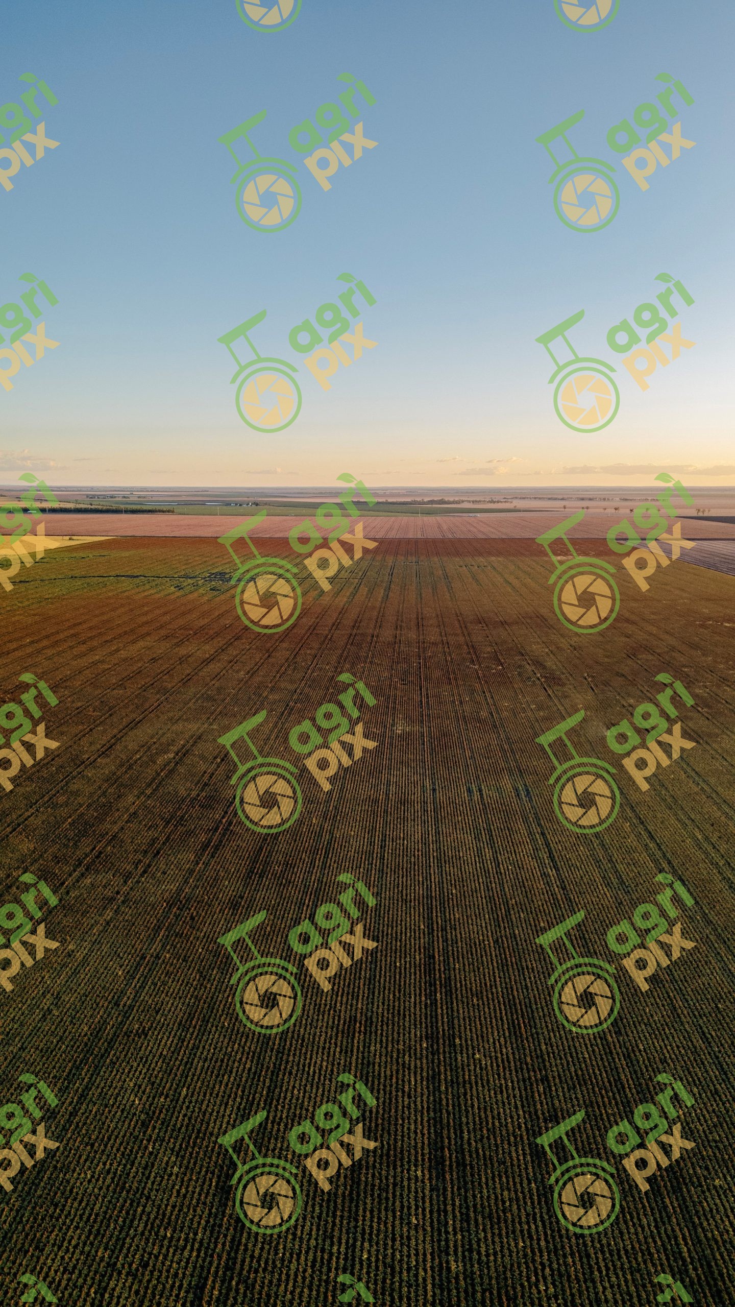
Drone View of Sorghum Crop on the Western Downs, Queensland Katie Robertson
A high-altitude drone photograph showcases the immense scale of commercial sorghum production across Queensland's Western Downs. Long, perfectly aligned crop rows extend across the foreground, creating striking linear patterns that lead the eye towards the distant horizon. Beyond the growing sorghum, a patchwork of cultivated paddocks stretches across the landscape, reflecting the region's highly productive broadacre farming systems. Soft golden light bathes the fields, enhancing the earthy tones of the crop while revealing subtle variations in growth and soil. The elevated perspective highlights the precision of modern agriculture, where large machinery, controlled traffic farming and careful crop management combine to maximise productivity. The expansive rural vista conveys both the scale and efficiency of grain production in one of Australia's leading agricultural districts.
The Western Downs is one of Queensland's premier grain-growing regions, producing significant crops of sorghum, wheat, barley, chickpeas and cotton. Sorghum is particularly well suited to the region's warm climate and variable rainfall, serving as an important summer crop for both domestic livestock feed and export markets. Drone imagery provides a unique perspective of the region's vast agricultural landscapes and the precision farming practices that underpin sustainable food and fibre production.